
By Matt Walker
For the four of us from TBH (Rachael Perowne, Susan Murphy, Ian Pickett and I), like many others, this event was supposed to have been last year. Unfortunately, after the organisers had been forced to relocate the 2021 event from Scotland to Cumbria due to COVID-19 restrictions, a storm relocated the event marquee and a last minute cancellation decision was made. But here it was, finally happening, three years after the 52nd, the 53rd edition of the Original Mountain Marathon was go!
The OMM (previously known as the Karrimor International Mountain Marathon, and before that simply The Karrimor) is a two day test of orienteering in challenging conditions and as such always takes place in the last weekend of October to make sure the weather has its say in proceedings. The extra confusion of dealing with the clock change is just an added bonus for competitors. Entries are in pairs and each team must carry all of the food and equipment they need to be self-sufficient and they only find out where they are going after crossing the start line each day. There is not even a set route, only a map marked with checkpoints, known as “controls” to be visited and areas which are out-of-bounds. Within those limits you make your own plan.
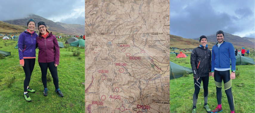
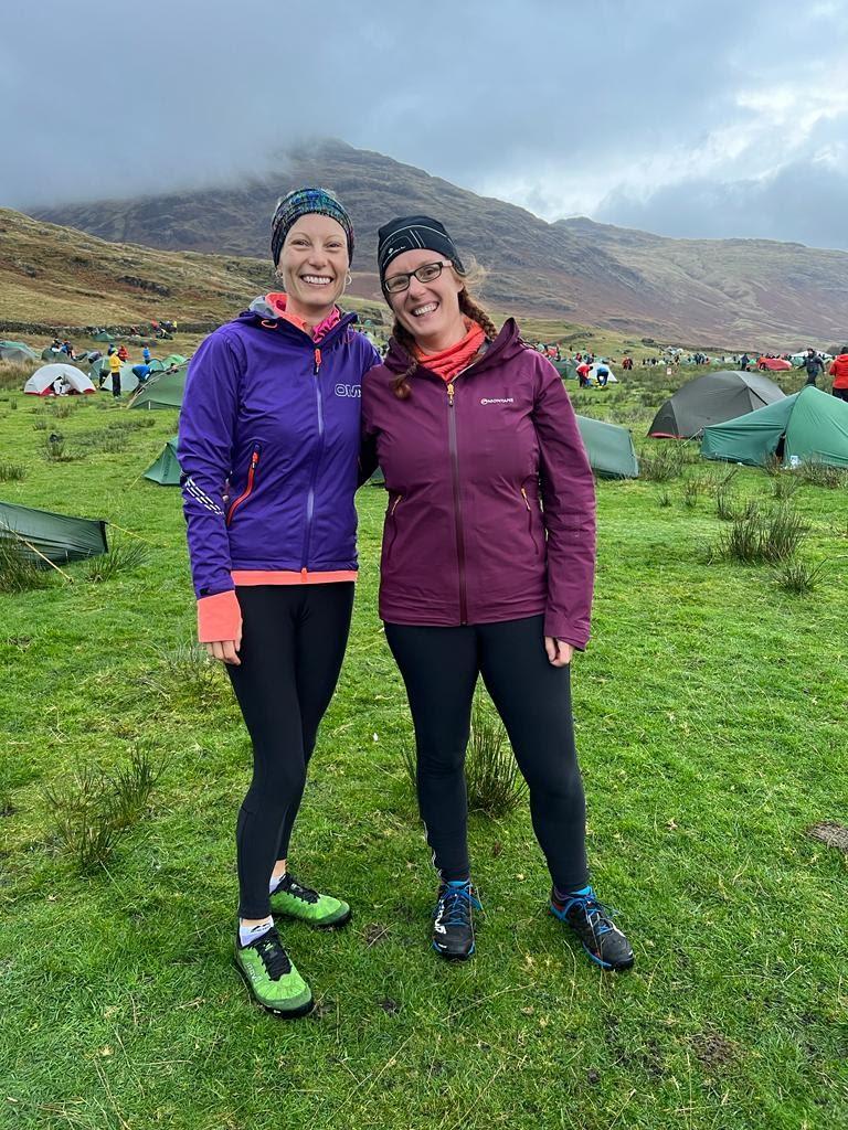
The event location changes every year and is slowly revealed as the event gets closer. This year’s HQ was Stool End Farm in the Langdale Valley in the Lake District. Coincidently, this was the location of the 2017, 50th edition OMM, an event both Ian and I had entered separately with similar outcomes. Beaten by the strong winds, relentless rain and low temperatures we withdrew on day one. Neither of us had been back to an OMM since but as a pair we had two successful Saunders events under our waterproof hoods in the last 18 months and were ready to right the wrongs of 2017 (Saunders, or the SLMM is another mountain marathon but being held always in the Lake District, and crucially in the summer, is a far more relaxed and pleasant affair!). Rachael and Susan were tackling their first OMM but had similar Saunders success to build on and were feeling confident.
Day 1
After an eventful drive over from the Hawkshead YHA, we got parked up and registered in time for Rachael and Susan to make the 2km march to the start line armed with their dibber and GPS tracker. No, the dibber is not for the game of bingo at the overnight camp, it’s a small plastic device that gets attached to the wrist of one of the team members and is “dibbed” at each control to electronically record that it has been reached. To prevent people from following each other, teams are set off at regular intervals and Ian and I had around an hour before our start window. We therefore courageously headed to the marquee for a cup of tea and shelter from the threatening rain.
The brews were soon finished and we were joining the other pilgrims on the track to the start, all of us trying to skip over and around the puddles, delaying the inevitable wet feet at least until we were on the clock. Predictably, the rain began as we waited to be allowed into the starting funnel and the waterproof jackets went on, as it turned out, for good. The atmosphere around the starting pens prickled like the rain drops on a water repellent coating, everyone eyeing each other’s bags with thoughts and whispered comments to their partners like “How have they got the minimum kit in those tiny bags?” and “That rucksack must weigh almost as much as her!” or my favourite genre “A block of Kendal mint cake says that toothbrush won’t be in the mesh pocket of his bag when he gets to the overnight camp”
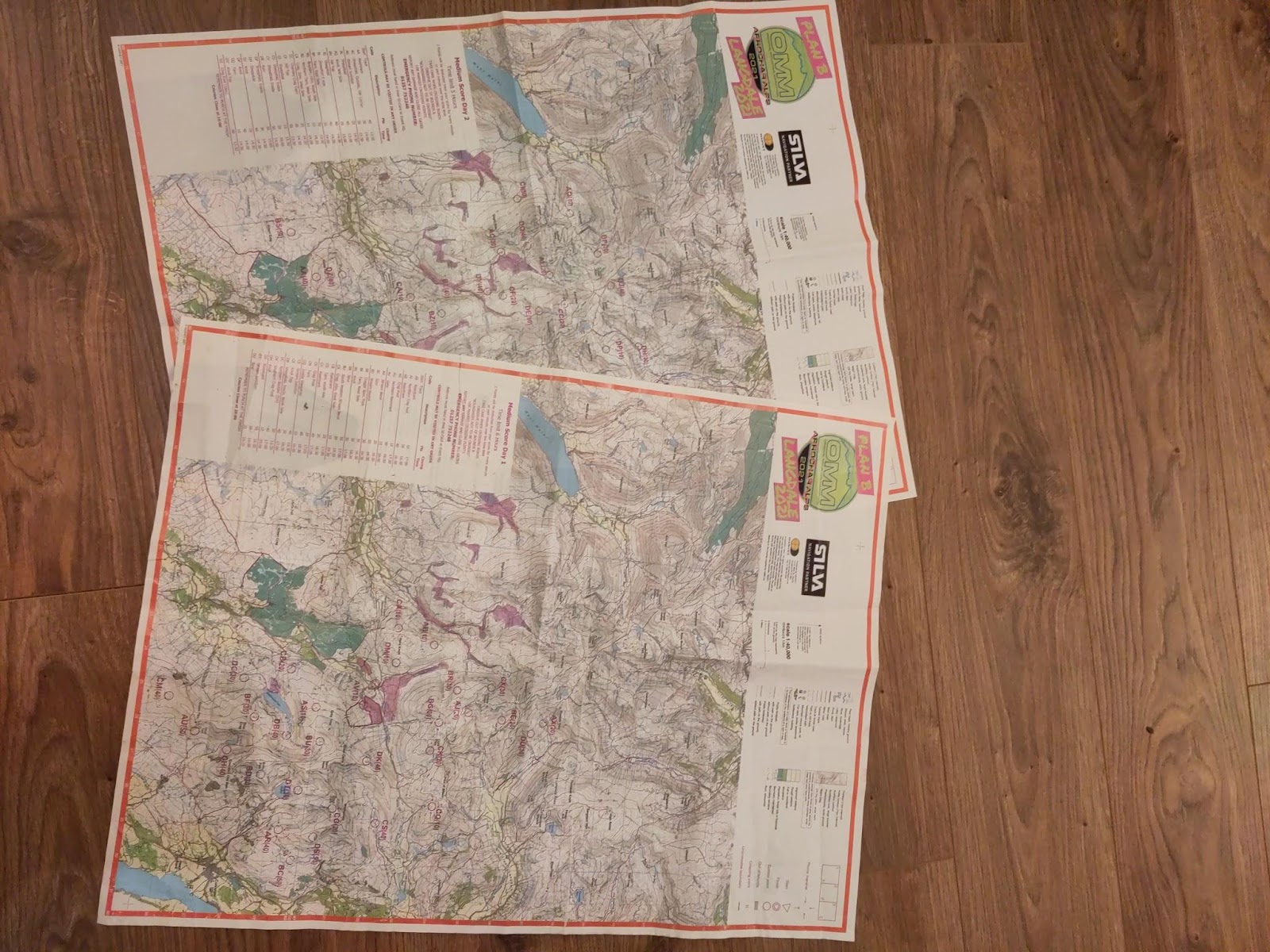
Joining the queue to start, it was clear that the medium score course was the most popular choice of the weekend adventurer. As well as the four of us, there were over 200 other teams in the medium class alone making it the biggest entry list of the six options. Score courses have no set route, only a map full of controls worth varying amounts of points and teams have to score as many points as possible in the available time. Teams have six hours for Saturday and five for Sunday in which to collect the precious points and deciding which ones to go for is key to maximising the use of your time without overrunning.
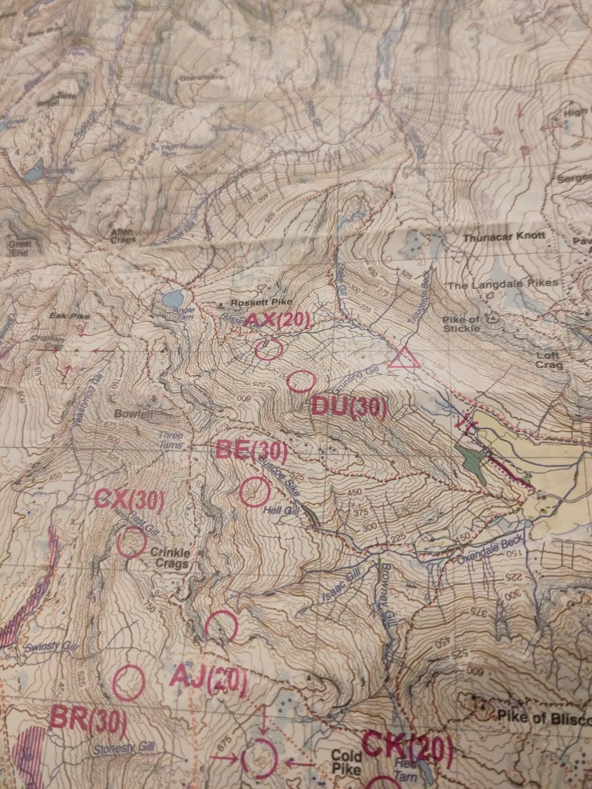
Finally, map in hand, Ian dibbed in for our start. As he had experience of this particular format before (all of my previous events had been “linear” where competitors navigate between a set of controls in a fixed order), I largely deferred to Ian’s judgement on overall tactics. There were two main groups of controls on the map, separated into north and south by the valley that the overnight camp and the day’s finish was nestled in. The start line was close to, and just southeast of, the most northerly controls. It was clear that hitting the controls in the southeast had a high scoring potential but getting to them required more than 6 miles on a road just to be in the end of the valley where the first points could be grabbed. It turned out that the highest scorers of the day would choose to do exactly this.
After a short discussion we opted for getting some points on the board early and decided on the nearby controls, a choice most of the field made. We had both been too excited for the off and had hit our first little bump. We had forgotten to start our watches and didn’t know exactly when we would reach our time limit and start to rack up penalty points! We took a conservative stab at how long our deliberations had taken and spent the rest of the day adding that number to our time when planning ahead.
With that little mistake though, we were underway and rolling along a fine Lakeland footpath, the imposing Great End ahead of us. As this was the Lake District you might expect us to be climbing pretty soon, and you would be right, the first control was around 200m above us, with the control description “stream bend”. A description one of us probably should have read a little earlier than we did. Again our excitement got the better of us and we both focused on a prominent feature within the circle marked on the map, a feature that was almost 100m from where we needed to be. A short pause and refocus before we got too far off target saved us though, and I decided that if that was the only bit of navigation rustiness we had all weekend I would be pretty happy.
For the next few controls all went smoothly. We climbed, we contoured, we squinted into the low morning sun that shone briefly in our faces as we climbed directly into it, never to be seen again that weekend unless you count when it shone on distant lands beyond the rain. By our fourth control of the day we were up at around 600m altitude and firmly in the cloud. In the low visibility we navigated well to the approximate location of our next chosen control and found a small crowd of very lost looking pairs. Because of the different choices teams make on the order to visit controls, and routes to take between them, it’s common to see nobody (especially when visibility drops below 50 metres) until you get close to a control. Now you can read more than just your map, the body language of your fellow competitors can tell you almost as much. Moving fast with confidence and tucking away a map usually means they have dibbed and heading assuredly to their next target, moving cautiously and scanning around in opposite directions are pretty good signs of a pair hunting for the little orange and white kite. These were all in hunt mode and we joined the effort.
Some were sure they should be standing on it, others decided it was behind the next crag; OK, the next one. It’s a strange moment where competitive spirit clashes with a collective goal. You all want to find it, and would be glad of help from anyone around, such as a gleeful shout between partners “this way Dave, I’ve spotted it behind this sheep!” or something of the sort would be music in the mist. But you also want to be the ones to find it, tucked in behind an inconspicuous rock, where you can spot it, dib it, and steal away into the fog leaving the others to continue their clock eating searches. Or is that just me being selfish?
One pair loudly and frustratedly announced that they had wasted 25 minutes and were giving up (a possible bluff to make others give up too while they claimed the points? Yes, I’m probably being paranoid now). Ian and I soon conceded that we too should move on. I had one last look at the map and suggested that if we were stood above the crags Ian had spotted then we must be somewhere below and west of the control. If we set off for our next target due east there was a chance we would happen on this one as we left. There it was, a few metres higher than where we first looked, tucked up on a shelf above a small crag with a poor Marshall in a tent beside it! He must have been having a great chuckle listening to us all looking for him. Ian had a wry chuckle of his own at the thought of his dad watching our squiggly efforts on the live GPS tracker as well.
Pouring over the results in the days after, while my kit was drying out, it was pleasing to see that we were the fastest in the entire field to reach the next control. We then carried on moving quickly as we picked up a well-trodden path that spat us out, grinning after a lovely descent, at the Three Shire Stone on Wynrose Pass. This was where we tried to be clever. Instead of taking the direct line over the ridge in front of us, climbing 150 metres to drop back down another 225, we could drop the 75 metres with 1km of road running, then contour around to the control. It was longer but saved a good deal of climbing and we were confident that the fast road section would more than make up for it. What we hadn’t accounted for was the waist high bracken carpet that covered the hillside we were heading for, hiding sodden ground and sharp rocks. This scrubbed off our speed, and I think it is fair to say a good chunk of our collective sense of humour.
Maybe it was the tougher weather conditions, or maybe time has softened the older memories, but I certainly feel that I had more moments during the OMM than the Saunders where my head noticeably dropped and the climb out of the bracken, as I felt my blister pop was one of these low moments. I should probably apologise here to Ian for relinquishing any attempt at navigation for half an hour or so and then being slow and grumpy on the long climb that followed. Even a double dip in the Greenburn beck to get to the control didn’t lift my spirits.
Luck was with us at the top of the aforementioned long climb it would seem though. I had seen a cairn marked on the map on the path we were aiming for, 750m before our control and had decided to forget all about navigation until we reached the summit. All that mattered was following the path, one step at a time. The cairn though was not a summit. Only a path marker. By the time Ian and I realised the mistake and that we hadn’t been looking for it we must have long since overtaken the pile of stones. The altimeter told us that we were actually pretty much at the height where our path would be closest to the control, some 30m below us. The trouble was we were both tired, had lost concentration and had little to go on to confirm our location now we had climbed back into the clouds. Ian suggested we press on and find the fork in the path that shouldn’t have been far ahead. From there we would have positive identification of our position and could navigate our way to the control more confidently, instead of simply guessing or using only the altimeter which is never to be fully relied upon, especially on a gentle slope. We found what we thought was the path junction not far ahead, took a bearing and set off for the control. I will admit at this point my confidence wasn’t high but I trusted Ian’s instinct, a tactic that has paid off many times before.
The control was at the foot of the highest and most southwestern of a line of crags and we were approaching from the south west. The first crag therefore should have been the one we wanted. When the altimeter showed us to be at the right height for the bottom of the crag the mist cleared slightly and there below us, was a crag. Below us? Was the altimeter out by the height of the crag? Then I noticed that over my shoulder sat a slightly higher, more southerly crag. That must be it. I pointed it to Ian and we set off, straight to the 40 point control, our highest scoring one of the day. To find it so quickly, having lost concentration, followed a bearing from what turned out to be the wrong position and with both of us tired was probably our month’s dose of good luck in the space of five minutes.
One more control to hit lay on almost a direct line to the finish, just over 2km away. It’s amazing what a spot of luck and a long grassy descent will do for the freshness of one’s legs! 10 more points in the pocket and we were soon back on tarmac, the marquee and finish gantry in sight.
We crossed the flags with just under 20 minutes of our time left, comfortable that we couldn’t have grabbed any more points without also getting a handful of penalty points. At -2 points per minute it was a hefty price to pay.
There was a printed set of interim results displayed for each category pinned to a board as we entered the camp and from it we learnt two things. Number 1: Our 270 points was, at the time the list had been printed, good enough for joint 3rd and number 2: the ladies had not finished yet. The list was around 30 minutes old when we arrived so both of these facts were almost certainly wrong (we were to be sitting in a healthy 22nd overnight). Rachael and Susan had an hour head start on us and should have been finished 10 minutes before the list was printed in order to avoid the point deductions. We decided they must have been there somewhere and had slipped in since the sheets were printed with hopefully only a small penalty. There were already a lot of teams setting up camp and one lightweight tent being put up by two people in waterproof running gear looks much like any other. We embarked on a live-action game of Where’s Wally to spot them whilst trying to find somewhere vaguely flat and not completely a bog to pitch the tent.
With our luxury two man tent up I was tending to my feet inside when I heard the familiar laughter approach. Ian had seen the ladies arrive while getting water for a well-earned brew and led them to our cosy camp spot.
I could not do their tale of adventure justice here but if ever someone proved they were tenacious and determined it was these two. With the weather closing in on them at their high location near Crinkle Crags and the cold wind biting, they had decided to head for the overnight camp. Arriving at a path junction they got out their compasses to confirm which route to take and found to their horror that they were pointing in opposite directions. One of them was obviously wrong, but which? After a little discussion, they picked Susan’s as the faulty one and were about to set off on what they thought was the trail to the overnight camp when another pair appeared. They said they were also done for the day and were heading back, and seemed confident in their route. The opposite route to one Rachael and Susan were going to take. It must have been Rachael’s compass that was misbehaving. They set off as a four, looking forward to a warm drink and a bit of shelter. But this was still only the beginning of their adventure. As they dropped towards the camp the white marque came into view…the familiar white marquee, with the parked cars in the field next to it. They were back at the start, not the overnight camp! The pair they had met were retiring, not heading to the finish.
At this point, a normal person would admit defeat, spend the evening in the event bar or one of the excellent Lakeland pubs in the area, sleep in Ian’s car (for which they had the spare key) and enjoy a nice relaxed day in the Langdale valley waiting for their friends to get back on day two. Normal people don’t enter the OMM. Normal is boring. No way were they letting it end like this, there was daylight yet and a six mile ribbon of tarmac between them and midcamp. And so it was that they arrived, disappointed but in good spirits, at the tent with a large collection of penalty points. So many in fact that their total, even after collecting some good controls, was -88, but they weren’t last!
I learnt this tale as the ladies pitched their tent and we set about preparing dinner. The rain had mostly held off while we made ourselves comfortable but the heavens opened (sending a swarm of runners to retrieve their drying clothes from the walls and fences around camp) and the four of us squeezed into the larger of our two tents to eat our rehydrated meals. One of the features of the OMM is time in midcamp. For the Saunders, being a summer event with the option to pre-order beer, time is spent well laying on the grass in the afternoon sun comparing notes on the day’s adventure. At the OMM it’s cold, dark and often wet, and the cramped lightweight 2-man tents do not lend well to torchlight card games. This is my excuse for why, at 6.30pm, Ian and I decided the best way to stay warm, dry and safe was a nice little nap.
Two hours later we stirred, ate our chocolate pudding desserts, made our final bedtime preparations and turned in for the night. As I laid in my cosy sleeping bag, listening to the rustle of the tent and the quiet hum of a large campsite settling in for the night I reflected that with the extra hour from the clock change and the early bedtime I was about to have the longest prospective night’s sleep for a very long time. The things I’ll do for a nice long kip!
Day 2
Sleep was thankfully less illusive than control four had been on day one, bar the usual interruptions when camping such as the wind rattling the tent and suddenly finding rocks under your sleeping mat that weren’t there earlier. Then there was one less usual interruption. I thought it was a gentleman suffering from cramp and loudly expressing his surprise and pain with a few choice words. Rachael is convinced the man had seen a fox. The word he shouted certainly did sound a bit like “fox” so we’ll never know!
One of the hardest parts of a mountain marathon is the morning of day two. Picture the scene with me for a moment. There you are inside a comfy, warm sleeping bag, sheltered from the rain, wind and cold outside. You know your legs are going to be stiff when you stand but for now they are at peace. Waiting for you, out there in the non-down swaddled world, are wet smelly clothes, sodden shoes, a heavy bag, sore limbs, more weather and more hills. But there is at least breakfast and a brew! The thought of a good morning brew is enough to stir any warm blooded Englishman from all but the most comfortable sleeping bags, and for the sake of saving weight that was at home. I didn’t have to think too hard though, the organisers kindly arranged for a piper to wake us all and I’m pretty sure he started next to our tent. I’m also told that the honeymooning couple (yes, that’s right!) Got an extra long rendition.
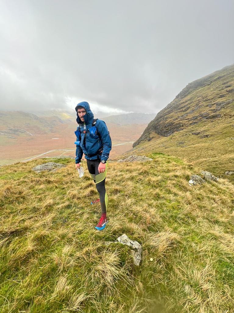
Ready to go for day two, looks like the clouds were ready for us too!
Again, the ladies had a start time an hour before us and we had a leisurely start once the ringing of the bagpipes had cleared from our ears. There was no rain but plenty of threatening clouds and a chill in the air so we deliberately dawdled with getting the tent down. We had no plans to get back in it but it’s nice to know you still have some sort of refuge if needed. Eventually the time came to strike camp properly, especially as the tent needed to be the first thing into Ian’s bag. Luckily it wasn’t as small as the one Mark Clarkson was carrying. Mark competes for Northumberland Fell Runners, my other club, and has an excellent track record at these events. He won the toughest class at both of the Saunders events I have done. Mark had pitched up with fellow NFR stalwart John Duff and they made excellent neighbours for the evening. The contrast between our kit was stark, I could probably have fitted Mark’s bag inside mine twice over, and had room for my snacks. Their lightweight, hardcore approach worked for them and they would go on to finish 9th in the longest of the linear courses in 14.5 hours.
Ian and I eventually made our way to the start line, me hobbling slightly on my two blistered feet, both hoping to warm up by getting moving. We had a small wait at the start line as the marshalls entertained themselves as much as the waiting runners with more energy than should be reasonably allowed at 8am on a Sunday. Their fancy dress theme appropriately seemed to be Mad hatters.
When we got our maps, and made the deliberate effort to start our watches on time, the day’s five hour clock started to tick. There were a few control options nearby to start us off and what looked like two main route options for the day, once the really distant controls were ruled out. For the first control we opted for a 10 point option 500m north of Hardknott Pass which would give us 2km on the road to get warmed up. Most of the others looked to be making for a control on the northern slope of Hard Knott but we hoped to improve our score by getting both. There was no repeat of the rusty navigation for control one this day, we were straight onto it and thoroughly warm, what with being 300m above the camp after only 36 minutes (in fact, we were the second quickest to the control on the day). It was quite amusing to arrive at our second control from a different direction to the steady line of competitors moving north, partly because it gave us an excellent guide for where the little flag was hiding.
We always try to start looking at our next leg before we have dibbed the control. Not only does this save time because you can plan on the move, but it means you aren’t hanging around next to the control kite like a beacon for everyone else to follow. It’s all about those marginal gains!
So it was for this control, we dibbed and were moving straight away, past the pondering map stands and confidently striding up the hill. Another nice moment of feeling like a well-oiled machine.
The next few controls were checked off relatively smoothly. We dropped down a steep slope to a large congregation around a sheepfold then set off on the left fork of the path for our next target. Here we decided to adjust our plan and collect an extra 10 points that were slightly off the route then cut back across to the path we were on. By now I was starting to notice the climbs a lot more and watching Ian stride on ahead became a familiar sight as the ground went up and my speed went down. I kept sucking down the gels as often as I remembered and we kept moving. Skirting around an area marked as out-of-bounds we picked up 3 more controls and a healthy 90 points. One of them involved an out and back from the path via some pretty serious scrambling. It’s times like that when I occasionally reflect that outside of a race situation I’d look up at some of these slopes and guffaw at the suggestion of going up them, but pop a tiny flag and at the top and I’m like Gollum crawling up the rock with a mad desire for the precious points.
After this section we had another decision to make. The consensus seemed to be climbing out of the end of the valley either to pass just below the summit of Great End for 40 points behind Allen Crags or pick up 20 from the summit of Esk Pike. Both options were over 300m of climb on some steep and rocky slopes. By now I had had enough climbing and was on the lookout for flatter options. A 50 point control in the next valley east was not only in the direction of the day’s finish, but could be reached with less than 200 metres of gain. Sounded like a winner to us. Even with less height to make the effort was tough, and the cloud came down to meet us. After a reasonable day so far we were going into some of the worst visibility all weekend.
We rounded the spur and tried to contour to the control, using the altimeter on my watch to guide us in the mist. Our plan was a standard navigation technique in these conditions, we were going to hit the stream slightly above the sheepfold where the control was hidden. We knew we couldn’t miss the stream, even in these conditions, and once we hit it, all we had to do was follow it downhill. The difficulty was trying to cross a very rocky mountainside with a 50% slope (this might sound like an exaggeration, but I have just measured it from my OS map!). I was picking my way carefully over the rocks, the wet stone and steep drop into the unknown mist adding a healthy dose of caution. I had to ask Ian to slow down so I didn’t lose sight of him. How was he moving so nimbly over this!? The answer, it turned out, was fear. My cautious reaction was opposite to Ian’s fear of heights driving him to get out of the situation as soon as possible, not really a perfect combination.
Our toil was not unrewarded. After 0.5km of this we could hear the water rushing down Yeastyrigg Gill and battering our hoods, I never realised you could have such heavy rain while in the cloud. This only added to the satisfaction when we reached the gully and saw, only metres below us, the orange and white kite! I think Ian would have jumped for joy if he was more sure of his footing.
We now had a decision to make and took shelter in the luxury sheepfold, complete with hearth and chimney (a roof would have been nice but you can’t be too picky in a downpour). We had around 90 minutes left to get to the finish and could make for it now, or try to get some more points. Options for points were realistically all beyond the 885m high summit of Esk Pike to the north. The direct route to the finish would still take us above 700m but the thought of saving some distance and the best part of 200m in height was enough for me, homeward bound we were!
If only we really had been dogs, the scrambling over more rocks on possibly an even steeper gradient would have been easier on four legs, I’d just have to pop the compass in my mouth. This time we were climbing as we crossed the slope and chance gave us the briefest of glimpses of the sassy shadow of a ridge ahead, the saddle where Three Tarns dwelt showing against the grey sky. We could see it just long enough to have our target fixed and we made steady progress towards it even after it was veiled out of sight again. Just over a kilometre of sharp, slippery progress, with the occasional silhouetted runners in the mist, got us slightly surprisingly right to the tarns. The tarns set us straight onto a clear path, and the bottom of the path was Stool End Farm. The bottom of that path was hot tea, warm dry clothes and food that didn’t come from a pouch.
The 3km run to the finish was the fastest 3km of the weekend. We flowed down the rocky trail like the water we splashed through most of the way down. The cloud gave way to a fierce crosswind, strong enough to push us offline as we leapt down the big steps. We swished past others presumably also on the way to the finish, swapping quips about how lovely the weather was. I fought the uneasy feeling that we were on the wrong path, paranoia driven by the unusual sensation of moving so fast for so long. But no, we were right again, and there was the great white beacon of a tent, and the lines of cars in the field. Ian must have been desperate for a brew, he really had the bit between his teeth now. I had been leading us down the hill but now he was away and flying.
We had one last option for points, 20 tempting ones back up near the day one start. On fresh legs I don’t doubt that Ian and I could have covered the roughly 5km it would be to get it and come back and not picked up a significant penalty. We were not on fresh legs, we were on legs that had been accidentally left out of the fridge until they smelt bad enough that the cat turned it’s nose up at them. It would have taken a will of iron to skip merrily through the comfortable hum in the finish area and back out for more. Our will was rusted from the relentless weather.
We dashed through the farmyard and dug in for the final effort over the line and to that last dibbing.
We quaffed a few cups of the most delicious warm blackcurrant I’ve ever had then went to answer the big question; were Rachael and Susan here, or at the wrong camp again?
They had made it! We joined them at one of the long benches of gently steaming runners and ate, drank and swapped stories. They had stayed in positive figures for the day but hadn’t been able to bring their total out of the red. Nevertheless they had thoroughly enjoyed their first experience of a score course and were already talking about future OMM adventures, clearly the weather needed to be really bad to put off these tough nuts! It was also pointed out that they had done better than Ian and I in 2017 by virtue of finishing, which I can’t argue with, well done ladies!
Once the final scores were on the doors I was properly chuffed to find that Ian and I, despite slipping a bit on day two had managed 29th out of 208 finishers. Fellow TBH member Jess Eaton had an excellent weekend also competing in the medium score course with her brother. They had a particularly good day 2 to finish 19th overall and 3rd Mixed team!
Ian is already planning to get to some local orienteering events for more practice and fun with a map in hand and the rest of us are looking ahead to more of the same. If this tale of adventure and top quality type 1 & 2 fun has piqued your interest and you want to know more you can grab any of us for a chat (we promise we will try not to talk at you for too long!)
If you are interested in the OMM 2023 find out more on their website https://theomm.com/the-omm/
Kit List
For those interested here is our rough kit list
| Matt (total pack weight: 8.4kg) | Ian (total pack weight: 5.5kg) |
| Mandatory Kit | |
| Backpack, OMM Classic 25l | Backpack, OMM Ultra 20 |
| Sleep system, Thermarest Neo Air sleeping mat and PHD down sleeping bag | Sleep system, Thermarest Neo Air sleeping mat and Rab Neutrino down sleeping bag |
| Survival bag, Harrier | Survival bag |
| Waterproof Jacket, Montane Spine | Waterproof jacket, OMM |
| Waterproof trousers, Inov8 Trail Pant | Waterproof trousers, Ron Hill |
| Compass, Silva baseplate type | Compass, thumb style |
| Headtorch, Petzl Nao+ | Headtorch, Petzl Swift |
| Hat and gloves, Inov8 | Hat and gloves, Ron Hill |
| Fell shoes: Inov8 x-talon | Fell shoes: Inov8 Mud Claw |
| Emergency food | Emergency food: Nature Valley Bar |
| Warm layer top | T-shirt, Rab Ascendor |
| First aid kit | First aid kit |
| 2l water bladder | 2l water bladder, Camelbak |
| Waterproof marker pen | |
| Mobile phone (for emergency use only) | Mobile phone (for emergency use only) |
| Baselayer, Inov8 | Baselayer |
| T-shirt | |
| Running tights | Running tights, 2XU |
| Gas, Primus 100g | Tent, Nordisk Telemark 2 |
| Stove, Coleman FyreLite | |
| Cup, Toaks titanium 450ml (for boiling water and hot drinks) | Cup, 370ml titanium |
| Additional Kit | |
| Garmin Fenix 6 Pro(GPS watches can be used to tell the time (elapsed and time of day) and for displaying barometric altimeter readings. Using them to measure distance or navigate is not permitted) | Garmin GPS watch |
| Magnesium lighter | Micro torch, for hanging in the tent |
| Homemade wind break for stove | |
| Camp food, Firepot dehydrated meals for dinner and breakfast | Camp Food, Summit meal and breakfast |
| Spare socks | Spare socks |
| Carrier bags x 2 (to be worn over dry socks, inside wet shoes when in midcamp, brand: waitrose left foot, Tesco right foot) | Carrier bags x 2 (to be worn over dry socks, inside wet shoes when in midcamp, brand: Sainsburys, disintegrated do not recommend) |
| Spork | Spork |
| Toothbrush and toothpaste | Toothbrush and toothpaste |
| Hill food, mostly gels, dextrose tabs and Maynards Sports mix (I left my sandwiches and pork pies in the fridge at home by mistake!) | Hill food, salted and roasted peanuts, Fruit Gums, banana, apple |
| Dry bag for spare clothes | |
| Insulated jacket, Rab Xenon | Down, Montbell jacket |
| Luxury Items | |
| Inflatable Pillow | Down trousers, PHD |
| Hot chocolate sachets | Down socks, PHD |
| Chocolate pudding | Mini Naan bread |
| Tea bags | |
| Chocolate pudding | |
| One wet wipe! |